Navigating can be challenging if you lose your GPS signal while traveling. Google Maps now allows downloading maps on smartphones to take care of that. After downloading the map, users can navigate and get turn-by-turn directions even without the internet. So let’s get started on how to use Google Maps GPS in Airplane mode.
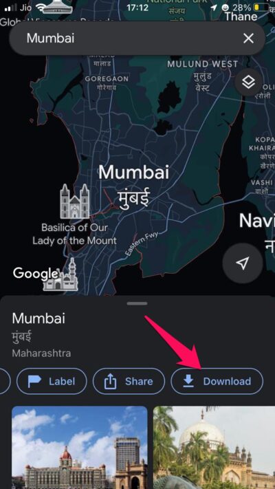
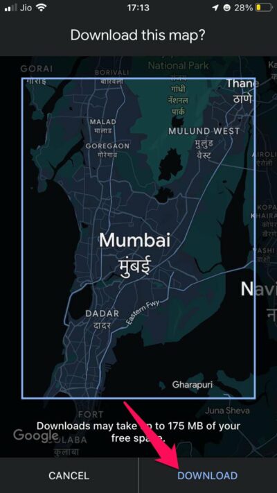
Step 1. Download Google Maps Offline
You can use Google Maps to show your live location without the internet but you won’t be able to see the map information as it requires internet data to load. Therefore, using Google Maps offline without an internet connection makes it easy to navigate. But still, it has some limitations. Also, the steps for using Google Maps offline are identical for both Android and iOS.
How to Use GPS without Internet?
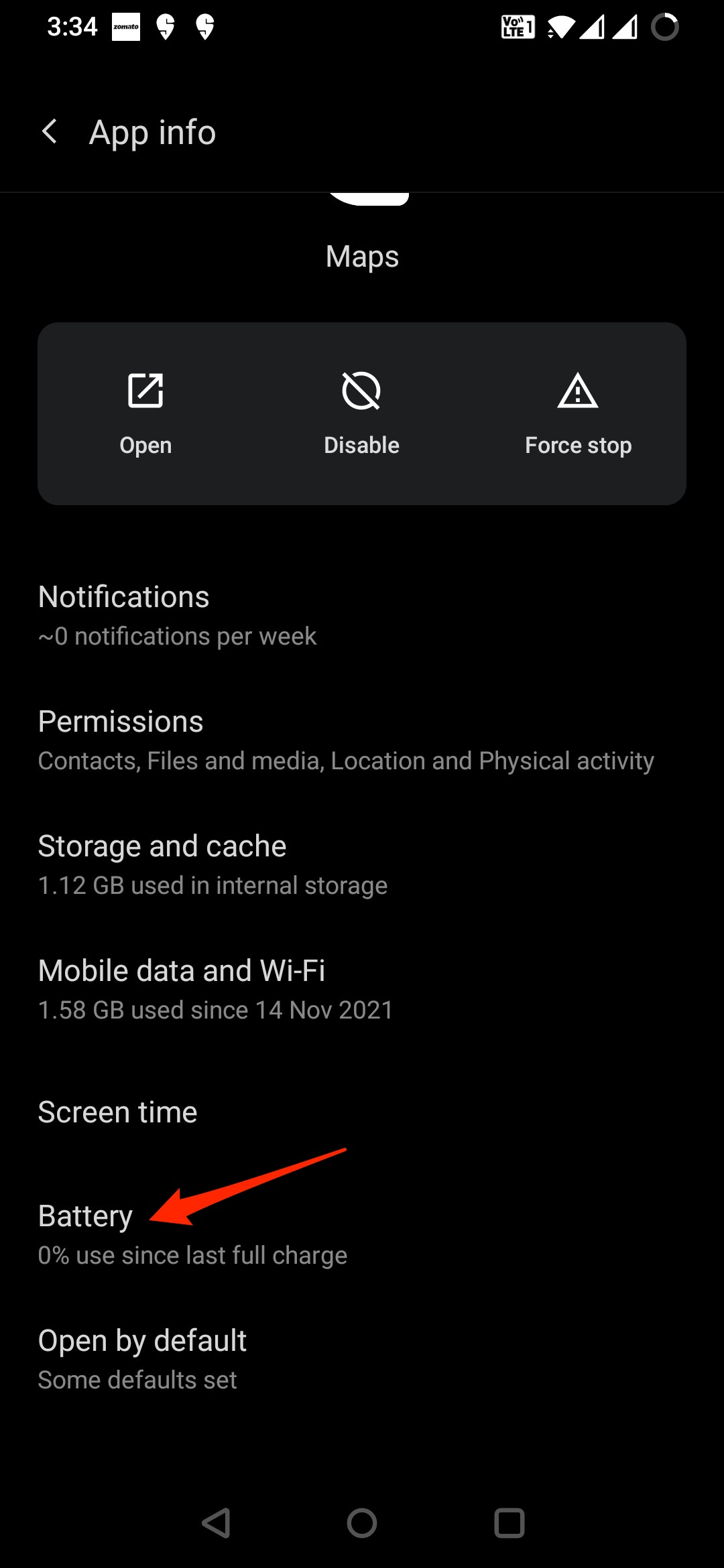
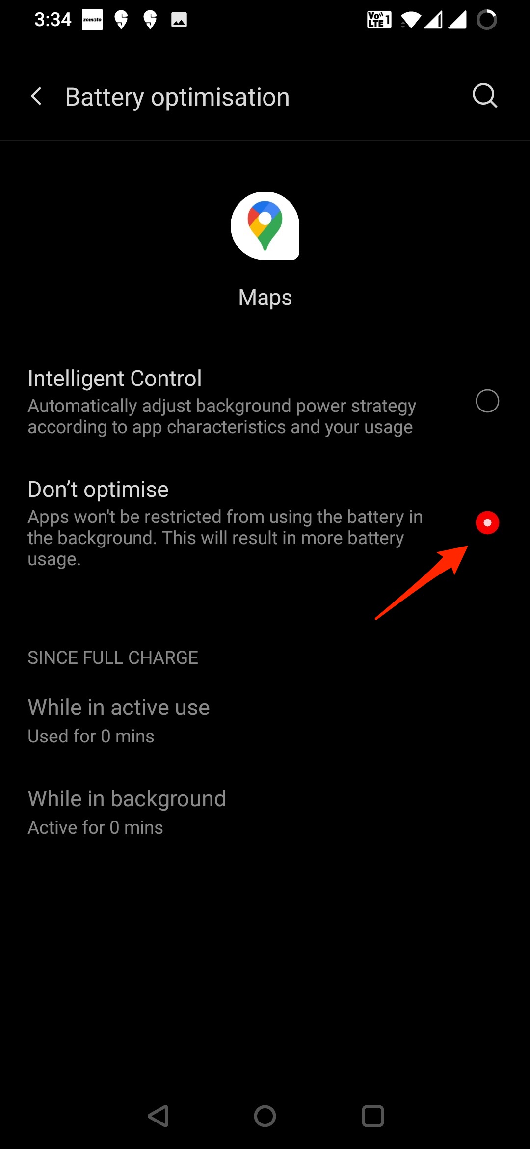
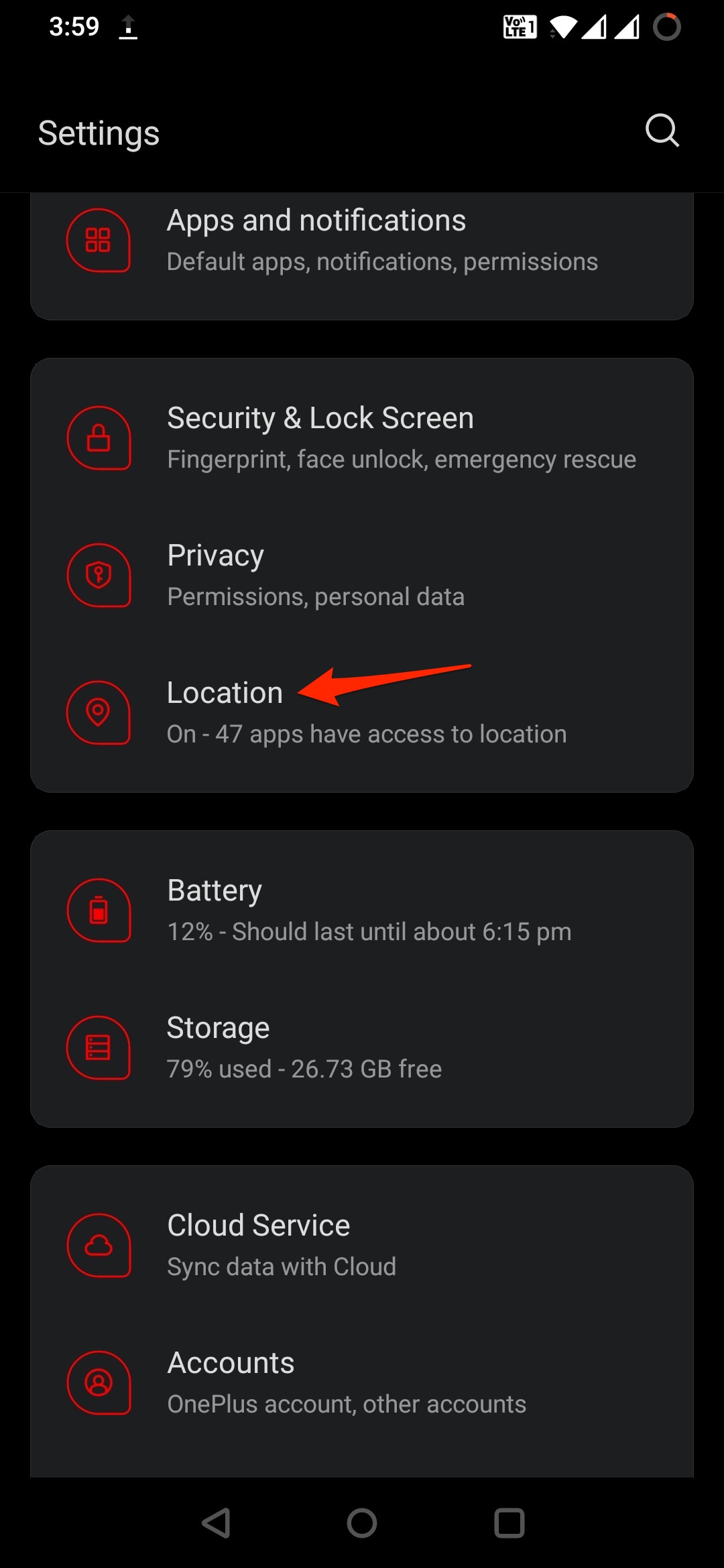
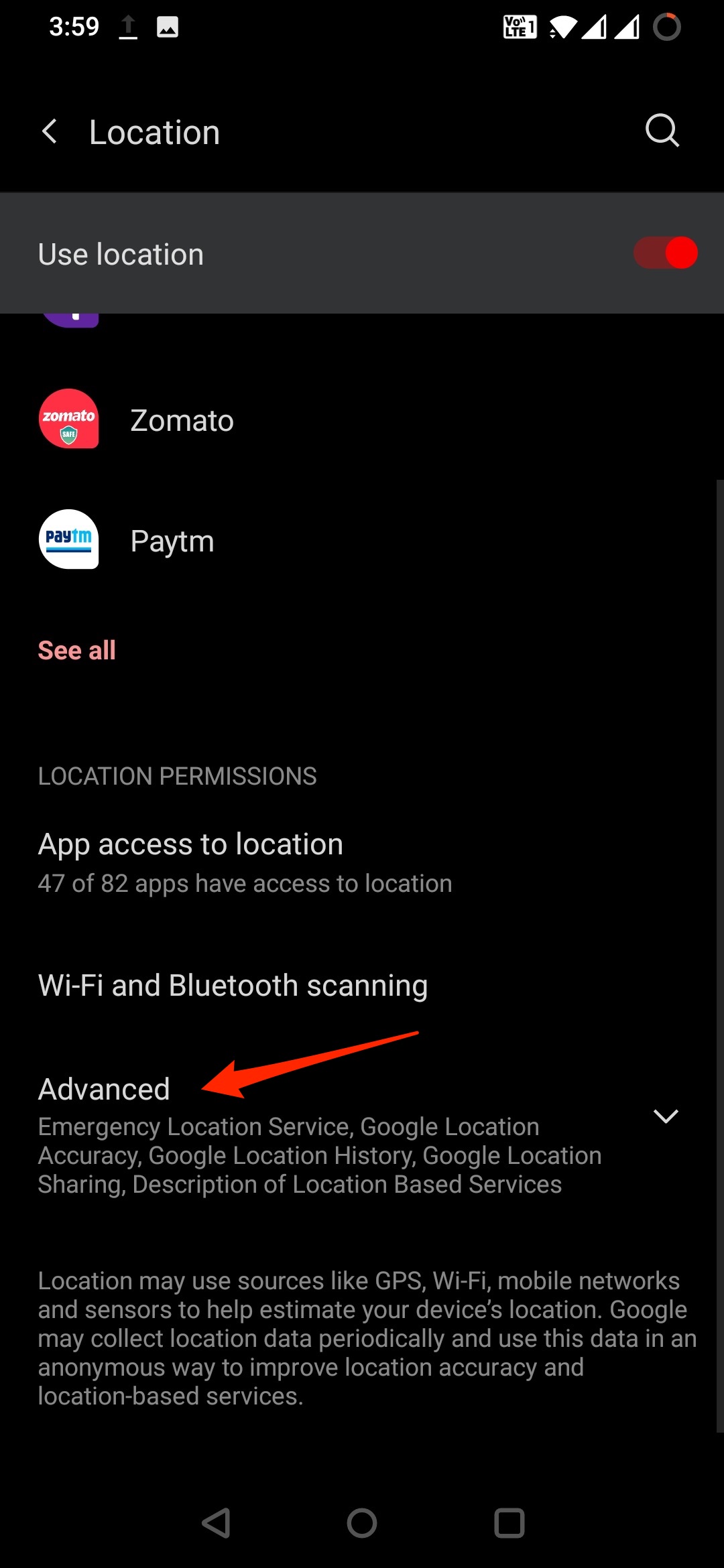
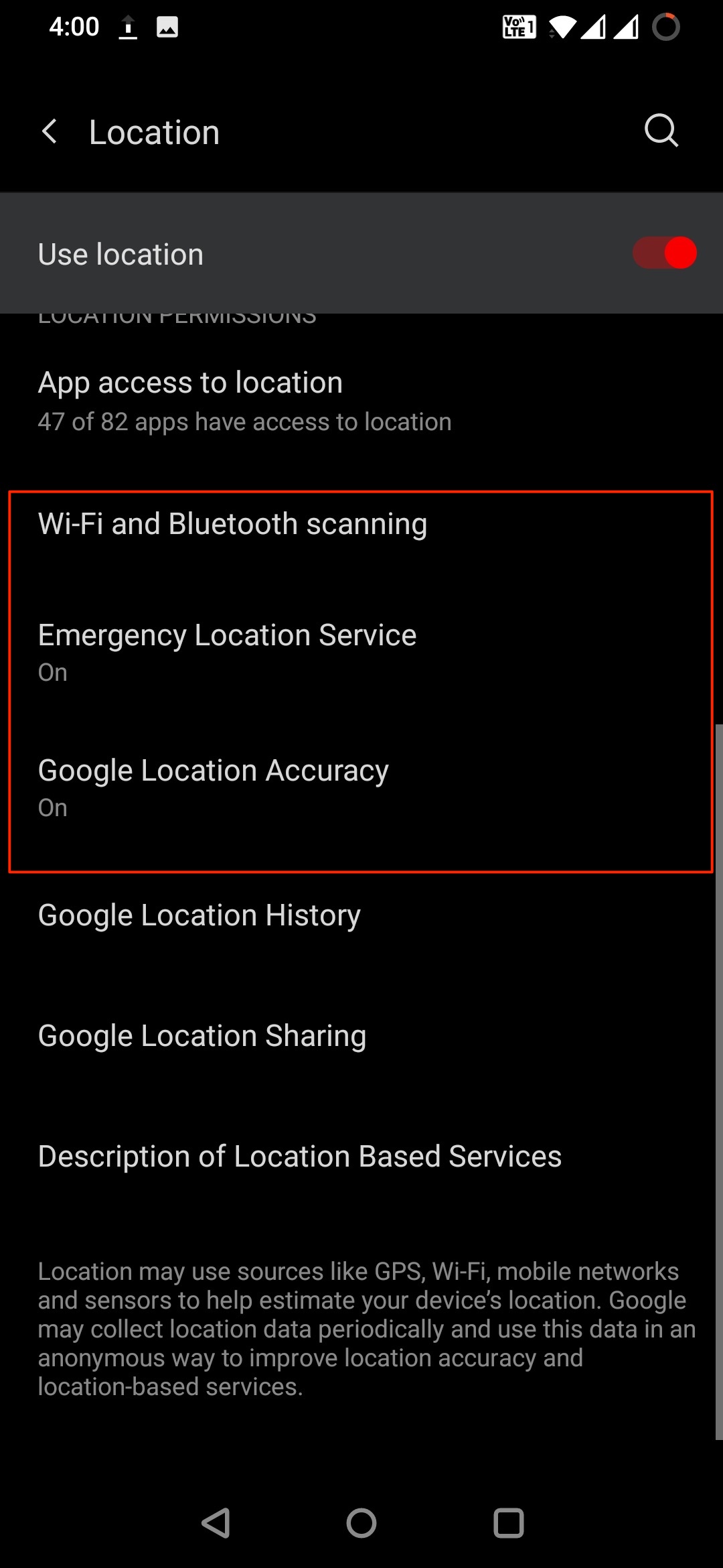
Now as you have downloaded the maps, you can set the Google maps to show your live location when you are out of the internet or in airplane mode. Maps use GPS satellite signals directly from space to show your live location but for this, you have to disable any battery Optimisation or other restrictions imposed on Google Maps app or Location services. This will block the phone from receiving GPS signals from space. To do so open, Settings → Apps/All Apps/App Manager → Maps App → Advanced → Turn off Battery Optimisation. Also, if you have any other settings restricting location services then it will not be able to catch the GPS properly. Therefore, it is good to remove all the restrictions from the Google Maps app. Open Settings and look for Location. Hee, Enable WiFi and Bluetooth Scanning, Emergency location service, and location accuracy to increase GPS accuracy.
Calibrate your Compass
If your blue dot’s beam in Google maps is wide or pointing in the wrong direction, you’ll need to calibrate your compass.
Refresh your GPS Data
Sometimes your device gets ‘stuck’ on certain GPS satellites, even if they’re not within range, causing it not to work properly. To fix this, you can use an app like GPS Status & Toolbox to clear your GPS data. In the app, tap anywhere on the screen → Menu icon → Manage A-GPS state → Reset, when finished go back to Manage A-GPS state → Download. Your GPS data will refresh. That’s all. This was how you can use Google Maps GPS in Airplane Mode. We hope the steps mentioned above were able to help you. Still, if you have any issues, feel free to drop a comment below. If you’ve any thoughts on How to Get Live Location GPS in Google Maps in Airplane Mode?, then feel free to drop in below comment box. Also, please subscribe to our DigitBin YouTube channel for videos tutorials. Cheers!
How to Fix Google Maps Keeps Rerouting on Android and iOS? How to Fix Google Maps Not working on iPhone? Google Maps takes users down a memory lane, sends users a ‘2020 Timeline Update’ via email to recap all the places they have visited.
Comment * Name * Email *